The next storm system is coming Tuesday. We’re right in the middle of winter and Mother Nature is here to remind us. We have a few systems on hand that will (or may) impact the region over the next week, along with more cold air. Yep, winter is here to stay for a little longer.
Tuesday’s Storm System
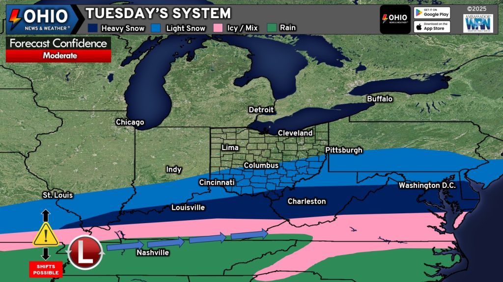
A low pressure system will track across the Tennessee Valley, bringing snow into the Ohio Valley. But, the forecast isn’t quite that easy. Models have not been very consistent with timing, temperatures, or precipitation type. Yes, even this close to the event and models are still not quite on board! This does happen from time to time, so it’s not unusual. The biggest issue models are having is whether or not warmer air (we’re talking 35-38 degrees) at the surface working its way northward far enough to switch snow to rain or allow for a mix of rain and snow. Either of those scenarios would drastically cut down on snowfall totals. Conversely, if warm air does not make it too far north, then the precipitation stays all snow and we could see higher snowfall totals instead.
Forecast Issues
Timing: Overall, the consensus is for snow to start a little after daybreak Tuesday from west to east. The snow would end between sometime early Wednesday morning, from west to east. Not all model guidance likes that timing, with some suggesting snow starting later Tuesday morning.
Precipitation Type & Temperatures: Sometimes we see warmer air at the surface wrap northward into these types of systems. This can cause havoc on a forecast, but it’s a known phenomenon and it’s also known that models typically do not handle this feature well. They will tend to underperform here where in actuality temperatures will tend to be warmer than modeled. Some of the higher resolution models have been doing better of at least hinting at this feature, if not showing temperatures making it to 37 or 38 degrees. What does all this mean? Well, it comes down to how warm does it get near the surface and what type of precipitation ultimately falls. If it’s too warm, we will see cold rain. If the column of warm air is shallow, then we could see some really wet snowflakes or a mix of rain and snow. Both of these scenarios cut down on snowfall totals.
Right now, most models are keeping the precipitation all snow, with temperatures at or just above freezing near the surface. This scenario would boast the highest snowfall accumulation.
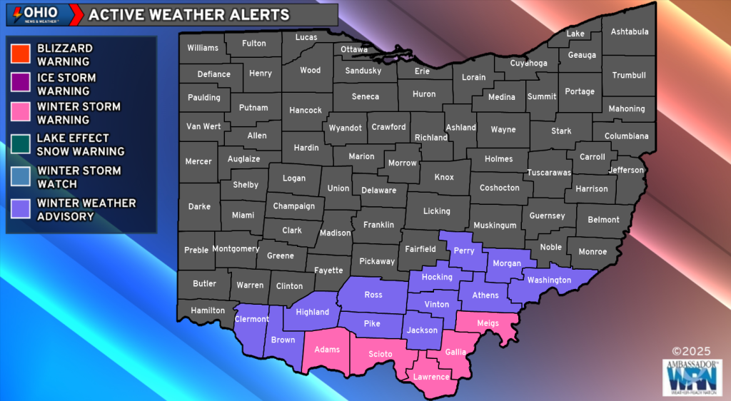
Latest Weather Alerts
Some Winter Storm Warnings and Winter Weather Advisories are in effect for our southern counties:
Check out the latest Snow Emergencies here.
The latest Weather Alerts can be found here.
How Much Snow To Expect

This is our latest forecast. It is subject to change should future model data warrant it. Please watch our Facebook page for the latest updates.
Behind the Snow
On Wednesday, things turn a little messy with the potential for some spotty freezing rain or freezing drizzle across Southern Ohio. This could also change to or mix with some snow or sleet at times too. Any freezing rain/drizzle/sleet could make some surfaces slippery, especially if it persists. Be careful on elevated surfaces, bridges and overpasses.
The next system then looks to impact Ohio Wednesday night into Thursday the the potential for another wintry mess of rain, freezing rain or sleet and snow. However, we will address that system in a future post.
Stay with Ohio News & Weather for the latest.