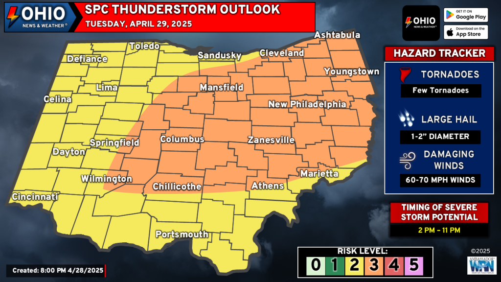
A threat for severe weather across Ohio on Tuesday remains in place, with an Enhanced Risk for severe weather across portions of Central, East Central and all of Northeastern Ohio. Elsewhere, a Slight Risk of severe weather is in place.
Setup
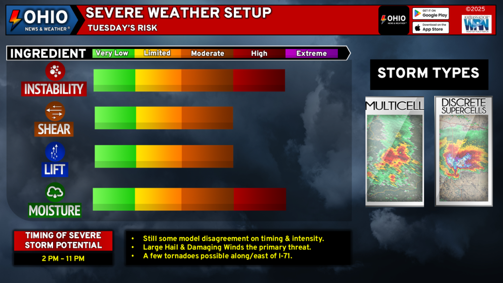
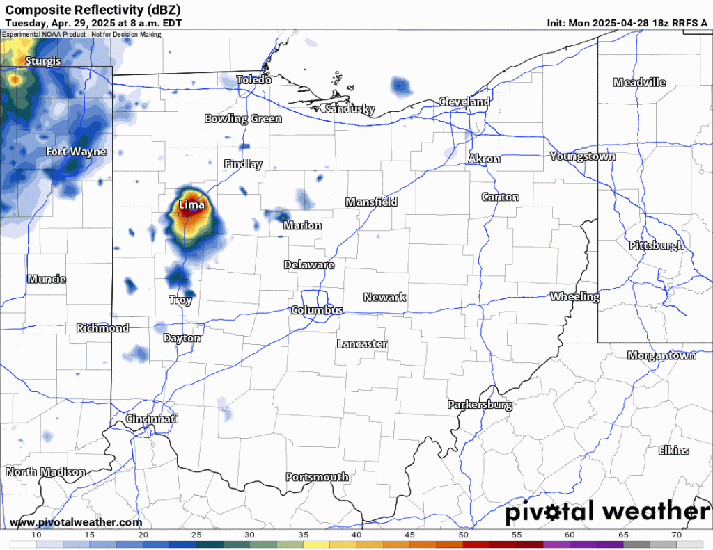
A warm front will lift across Ohio Monday night and early Tuesday. Rain and perhaps a few thunderstorms will move across portions of Ohio early Tuesday morning before tapering off. Behind it, the airmass should recover enough to allow for a warm and unstable airmass to aid in the development of thunderstorms by mid Tuesday afternoon across Indiana and Western Ohio as a cold front approaches the region.
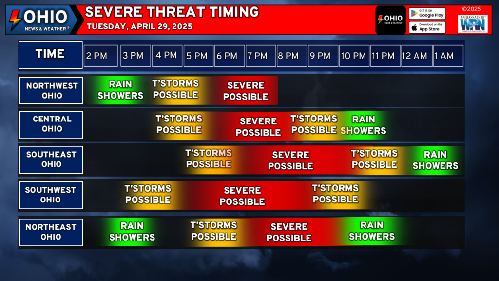
Thunderstorm development will continue into Tuesday evening and progress eastward. As the sun sets, we’ll gradually see storms weaken but there should be enough instability and wind shear aloft to allow for storms to continue to around 10 PM to midnight before either moving out of the state or taper below severe levels.
Threats
- Damaging wind gusts to 70 MPH.
- Large Hail approaching 2” in diameter.
- A few tornadoes, primarily along and east of I-71 and North of I-70.
Damaging wind gusts and large hail are the biggest threats from any storm that develops. Conditions across the Enhanced Risk area will support the potential for the possibility of a few tornadoes.
Multicells and a few supercells are possible. Supercells will be capable of producing very large hail up to 2” in diameter and perhaps a tornado or two. Over time, the overall storm mode will transition to a linear mode with a damaging wind threat.

Need a Weather Radio? Check out this portable FosPower Solar Powered and Hand Crank Weather Radio with Portable Power Bank!
Timing
See the graphic below for approximate timing of severe weather. Keep in mind that this is dependent on exactly when storms develop and could vary.
Limiting Factors
Models continue to have some disagreement on the overall timing and coverage of storms. Additionally, morning convection across Northern Ohio could potentially limit the northern extent of severe weather, especially if the airmass is not able to fully recover. These factors will need to be monitored throughout the day.
Stay up to date on the latest weather alerts! Download our FREE Ohio News and Weather app on the Apple App Store and Google Play. Plus stay up to date on the threat for severe weather across Ohio on Tuesday by following us on social media.