By now you have probably heard or seen a few rumblings about the potential for severe weather late this week into this weekend. While the best threat will be across the Southeastern US, severe weather is possible this weekend across much of Ohio Saturday into early Sunday.
Synopsis
Timing: Late Morning Saturday, March 15, 2025 through early afternoon Sunday, March 16, 2025.
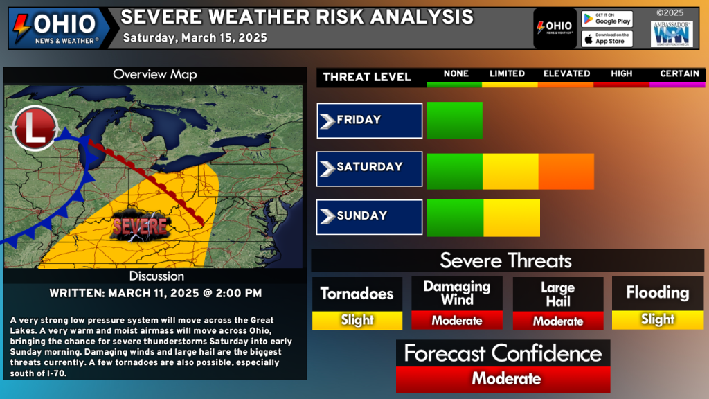
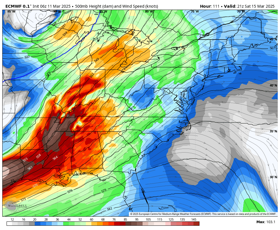
A very strong low pressure system will track into the Upper Midwest and Great Lakes by Friday. This system will then track over the Great Lakes this weekend, dragging a very powerful cold front with it. Ahead of the cold front, a robust warm front will user in warm and very moist air into the Ohio Valley. Strong winds, but aloft and at the surface, will also move into the region. Strong winds, combined with a very warm and unstable atmosphere will allow for the development of thunderstorms Saturday through early Sunday. Some of these storms may be strong to severe.
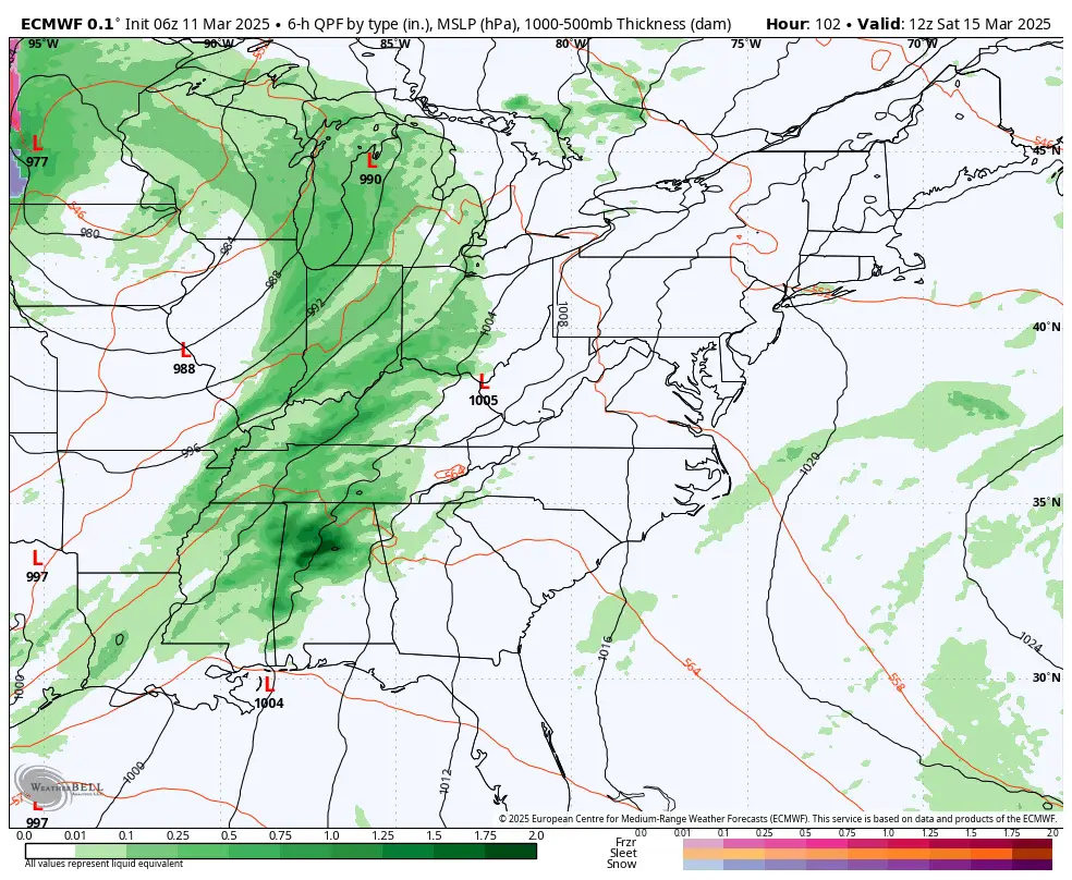
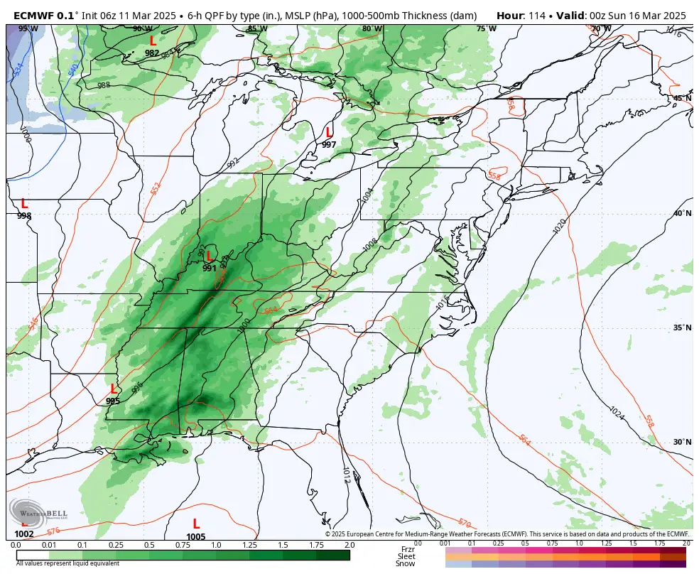
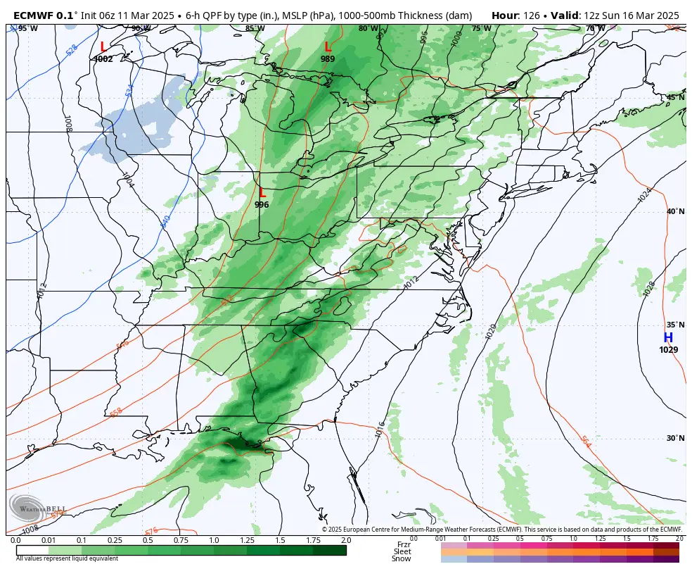
Surface Maps
Currently, none of the short range convective allowing models reach into this timeframe. Therefore, we only have medium to long range model data to use, which is typically not as robust as the short-range models. Of these, the GFS, European and Canadian models, are all generally similar with timing and placement. As we get closer to Friday and Saturday, the short-range models will hone in on dynamics, timing and placement. Therefore, expect changes to the forecast as we get closer to the weekend. Remember, models are guidance, NOT a forecast and change as more data comes in.


Need a Weather Radio? Check out this portable FosPower Solar Powered and Hand Crank Weather Radio with Portable Power Bank!
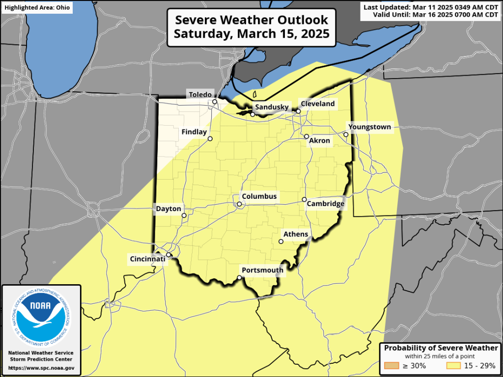
The Storm Prediction Center is also highlighting much of Ohio in it’s Day 5 Severe Weather Outlook. At this range, they only highlight probability and do not assign categories (slight, moderate, etc). This won’t happen until Thursday however, at this time, we expect a Slight Risk to be placed somewhere across Ohio by then.
Winds
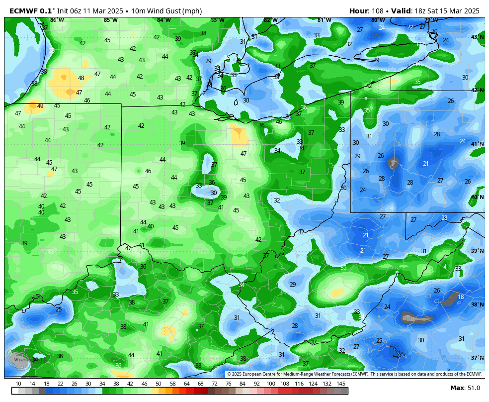
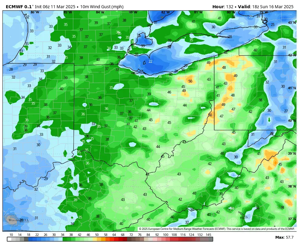
Hang on to your hats because it’s going to be WINDY – both at the surface and aloft. A mid-level jet streak across the lower Ohio and mid-Mississippi Valleys will also help to bring some very strong southwest winds across Ohio. Sustained winds of 15-25 MPH will gust to near 50 MPH at times Saturday and even into Sunday before the cold front passes. Much of this will be associated with the rain and storms traversing across the region, however, there may be a period of time on Saturday where we will have strong winds and be in between rounds of rain/storms. Power outages are possible.
Threats
Severe weather threats include:
- Damaging wind gusts: Wind gusts between 60-70 MPH are possible with thunderstorms. As previously mentioned, wind gusts to near 50 MPH are also possible outside of thunderstorms.
- Large Hail: Some of the thunderstorms will be capable of producing large hail in excess of 1” in diameter.
- Tornadoes: A few tornadoes are possible.
- Flooding: Portions of Southwestern Ohio could see close to 2” of rain. Some minor flooding in low lying areas is possible.
It’s a little too soon to get into specifics as to exactly who will be impacted by what and when however, it does appear that areas south of I-70 have a higher threat for severe weather than areas north of I-70. While we, and the SPC, have much of Ohio highlighted for severe weather potential, we will need to wait until we get closer to the weekend to get into better detail on which threats exist and where those threats will be placed.
Again, severe weather is possible this weekend. Details will change so please be sure to stay tuned for the very latest updates.