It goes without much argument that most people would typically like to see some snow on Christmas. The ambiance of crip, cold air, some fresh snowfall, Christmas lights twinkling off the snow at night, sweater weather… ahh yes. You can almost smell the fresh pine boughs, taste the fresh baked cookies with some fresh brewed coffee or hot chocolate. Mmmmm. But a tropical Christmas? Who wants that???
Ok, I know a few of you wouldn’t mind that. Especially for those who are putting in a pool.
While it may sound like we’re alluding to a nice, warm, Christmas with a tropical ambiance, it won’t quite be that way.
A Tropical Christmas After All?
Let’s dive into some specifics. For longer term forecasting, we mainly focus on trends in the upper air pattern and how that relates to trends at the surface. We look at what the jet stream does, upper air “height anomalies” (areas of high or low pressure compared to a standard atmosphere) and general precipitation trends.
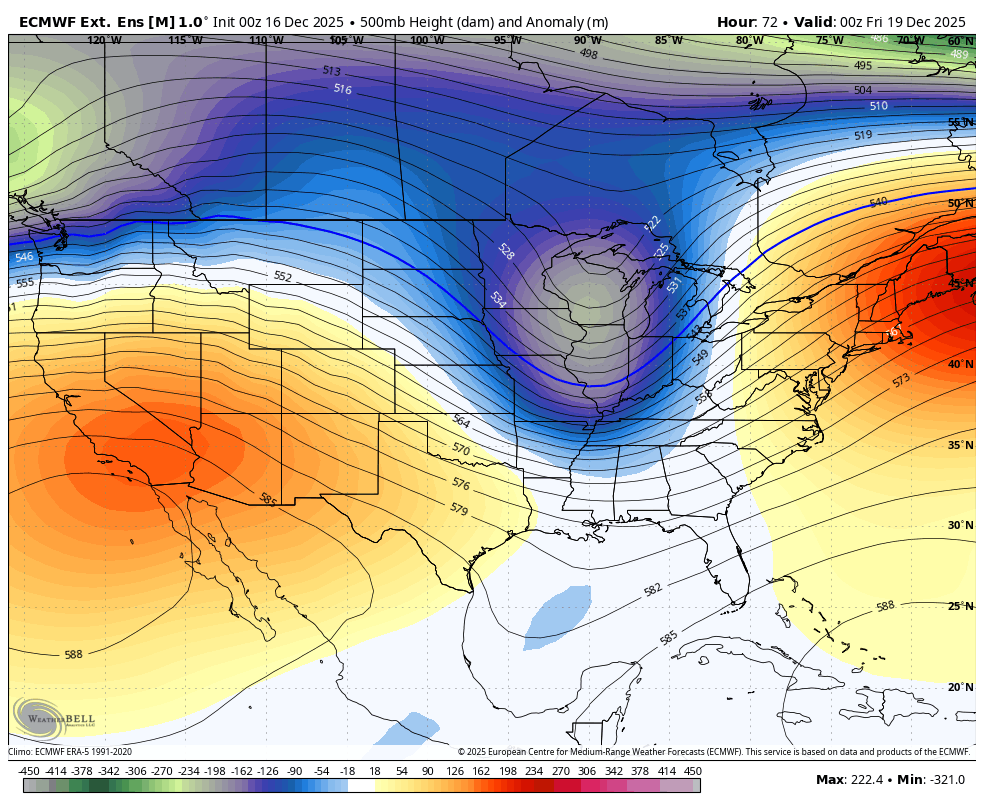
Long term guidance currently suggests that we see a brief cold shot Thursday and Friday as an area of strong low pressure drops across the Great Lakes (as seen above). Ahead of it, warm air will surge into Ohio, along with a fairly moist atmosphere and gusty winds and rain. This will help to erode most of the snow we recently experienced. In some places, the snow may melt entirely. A strong cold front will then follow Thursday night, gradually changing from rain to snow. As a cold airmass aloft swings through, some lake effect snow is also possible. Minor accumulations are possible and with the quick drop in temperatures, we could see a flash freeze, where wet surfaces quickly freeze over. This is most prevalent on bridges, overpasses and sidewalks. Treated surfaces will not be as susceptible to a quick freeze. Any lake effect snow that does develop ends on Friday.
Torches and Palms?
Before you start cranking the melodic tunes of “Mele Kalikimaka” by the pool, you may want to consider some warmer clothing and perhaps just an inflatable palm tree. Hey, some people love a tropical themed Christmas!
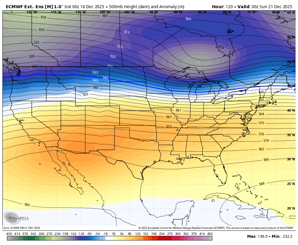
The overall upper air pattern will become more zonal – that is, flat – with a more west to east flow, as shown above. This generally means stable temperatures. We could see some brief periods where temperatures are a little warmer or even a little cooler, depending on exactly where the jet stream is located and if there happens to be any minor disturbances along it.
What do we expect to see? There’s decent concurrence on an overall warming trend for a large portion of the United States by Christmas. Locally, we could see highs ranging from the upper 40s/low 50s to low and middle 60s! Oh, this doesn’t mean it comes with plenty of sun and pool weather.There may still be chances for rain and some long range models are hinting at rain for Christmas. A white Christmas doesn’t appear to be very likely.
Tropical After Christmas?
As we get through Christmas, expect an unsettled pattern to return. When, exactly, is up in the air. Some models have rain and cooler weather starting to return as early as Christmas Day, while others hold off an additional day or two. Regardless, at this point, we can expect to see some cooler weather return, before the end of the year and into the start of the new year as the overall heat dome breaks down and the upper air pattern becomes more zonal (image below). Time will tell if these trends hold as we have already seen what looks to be strong signals for warmth or cold a week or so away break down as we approached those time frames.

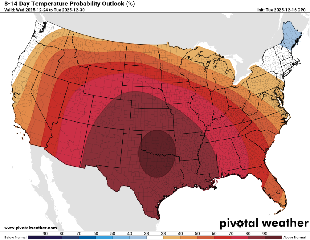
The latest forecast from the Climate Prediction Center takes us through the end of December and boy, it sure looks H-O-T! But remember, this is a map depicting PROBABILITY. What is being displayed is the probability of above or below normal temperatures. The darker the colors (red OR blue), the higher the probability (confidence) in temperatures being above or below normal. Sometimes it correlates with well above average temperatures, but not always. Give the current long range guidance, it’s fair to say that we look to see at least a brief period of above average temperatures around Christmas and into late December.
Heading into 2026
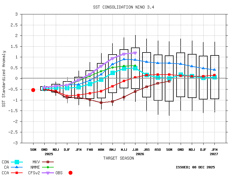
While we may not have a warm but not overly Tropical Christmas this year, we could see some tropical weather by the summer of 2026. The current La Nina pattern will gradually transition to an El Nino by the spring, perhaps sooner. We look to start trending toward an El Nino sometime in January or February. This trend then continues through the spring and into the summer, entering a weak to almost moderate El Nino. This could bring some rather warm temperatures to the Eastern United States along with the potential for an active spring with severe weather. Time will tell as everything needs to set up just right.
For the second half of winter, we could see a gradual warmup and quieter weather with less snowfall chances and generally quieter weather. However, as we transition closer to neutral territory, anything goes. We’ll have equal chances for warm ups and brief blasts of cold air and snow.
Not So Tropical Christmas After All
While we shouldn’t break out the swimsuits and suntan lotion, we can be fairly confident that we’ll see warmer weather than typical for Christmas, which may mean a light jacket (or none at all) over a heavy winter coat, hat, gloves, scarves and boots. Winter is just getting started and we’ll likely still see shots of cold Arctic air and snow before we begin a gradual warmup over the second half of winter.
Stay up to date on the latest weather alerts! Download our FREE Ohio News and Weather app on the Apple App Store and Google Play. Plus stay up to date on the threat for severe weather across Ohio on Tuesday by following us on social media.