A cold front will move across the Great Lakes, providing enough moisture and lift to generate light snow Wednesday night. Some minor accumulations are possible, primarily across Northeastern Ohio Wednesday night into early Thursday morning. Fortunately, this won’t be a big event.
The Details
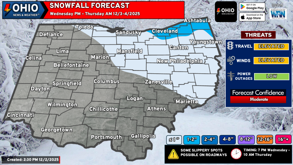
WHEN: Generally after 6-7 PM Wednesday through approximately 10 AM Thursday. Some lake effect snow showers may linger into early Thursday afternoon.
WHERE: Generally the Cleveland Metro and points east.
HOW MUCH: 1-2″ of snow may accumulate in the areas shaded in light blue. A few spots could see closer to 3″ in the higher terrain of Geauga County but this looks limited. In the areas outlined in white, generally 1/2″ or less for most areas. If you are outside of these areas, some light snow showers or flurries are possible with little to no accumulation expected.
IMPACTS: Secondary roads and untreated surfaces could become slippery. Gusty winds will blow the snow around and reduce visibility. It will also turn colder behind the front – watch for any wet surface to refreeze if not treated.
Stay up to date on the latest weather alerts! Download our FREE Ohio News and Weather app on the Apple App Store and Google Play. Plus stay up to date on the threat for severe weather across Ohio on Tuesday by following us on social media.