Winter: A Cold Start and a Volatile Finish
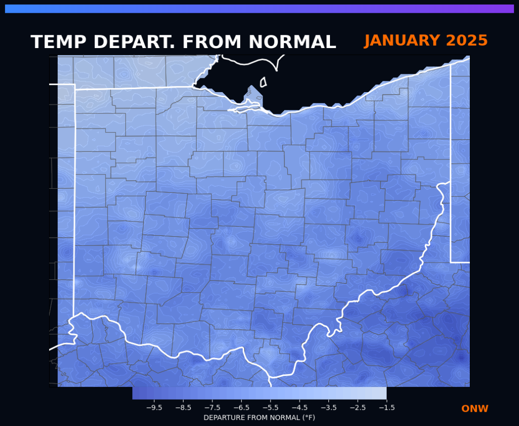
January: The Deep Freeze The year began on a chilly note. January 2025 ranked as the 27th coldest January on record, with temperatures generally running 5–8°F below normal. It was also a relatively dry month (13th driest), but when precipitation did fall, it made an impact. A significant winter storm struck Southern Ohio on January 5–6, dropping between 5 and 12.5 inches of snow and causing treacherous travel conditions along the I-74 corridor.
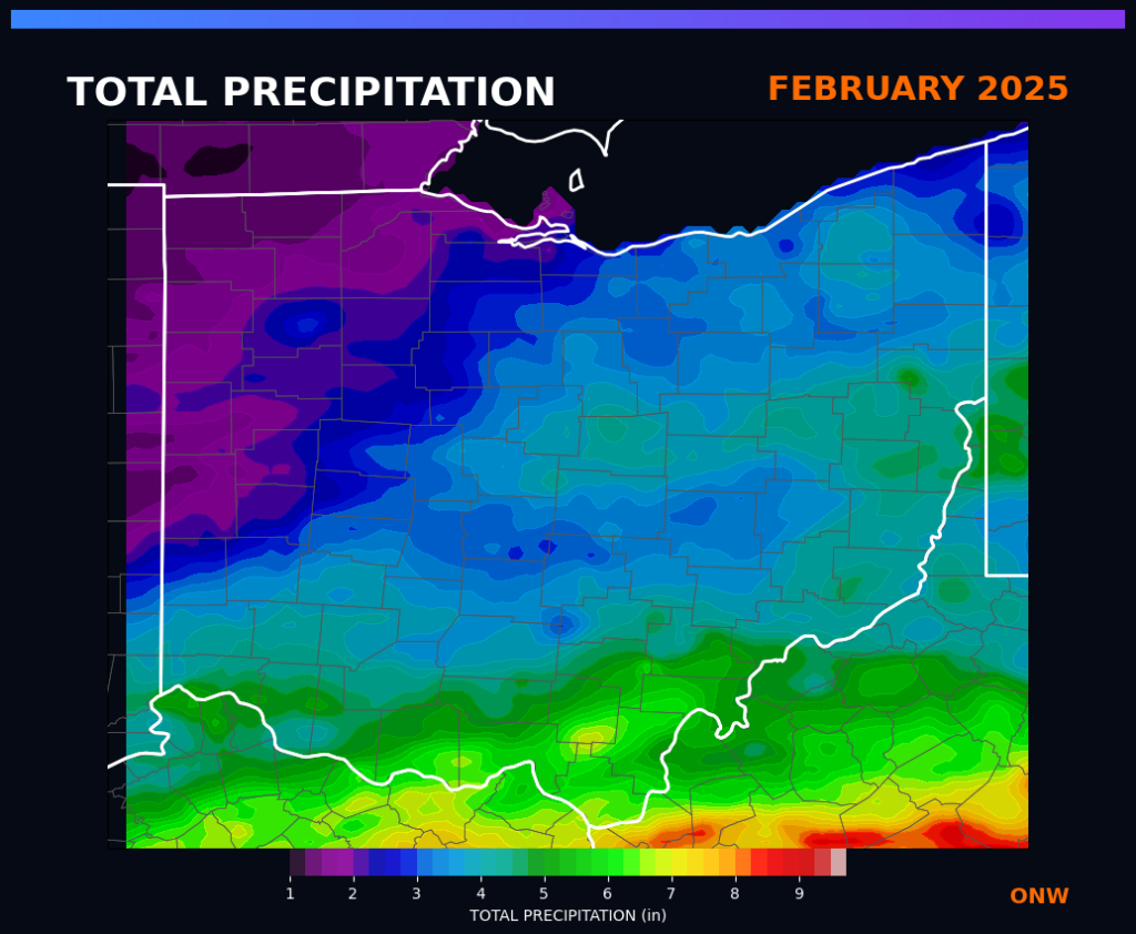
February: Whiplash and Floods February felt like a rollercoaster. While average temperatures ended up near normal, this masked wild swings between unseasonable warmth and bitter cold. The month was active and wet, ranking as the 26th wettest February. The combination of heavy rain and melting snow led to widespread flooding in southern Ohio on February 15–16, particularly east of Cincinnati and around Athens.
Spring: Severe Storms and Soaking Rains
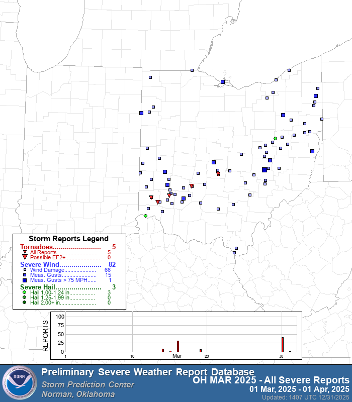
March: The Warmth Arrives Early Spring sprung quickly with the 9th warmest March on record. While the month was drier than average overall, it kicked off the severe weather season early. A strong storm system on March 30–31 produced five tornadoes in the state, including an EF1 in Fayette County and multiple EF0s in Butler and Warren counties.
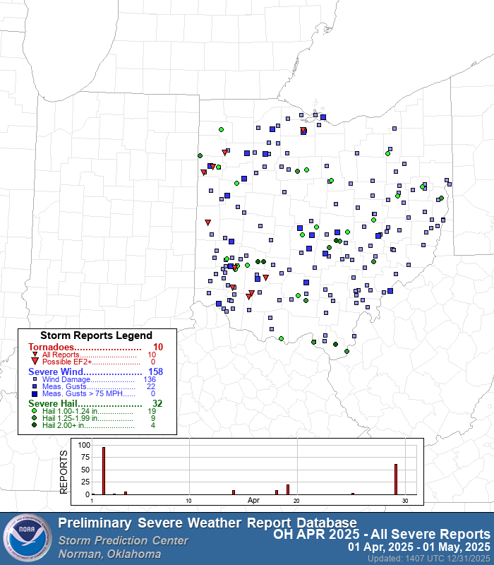
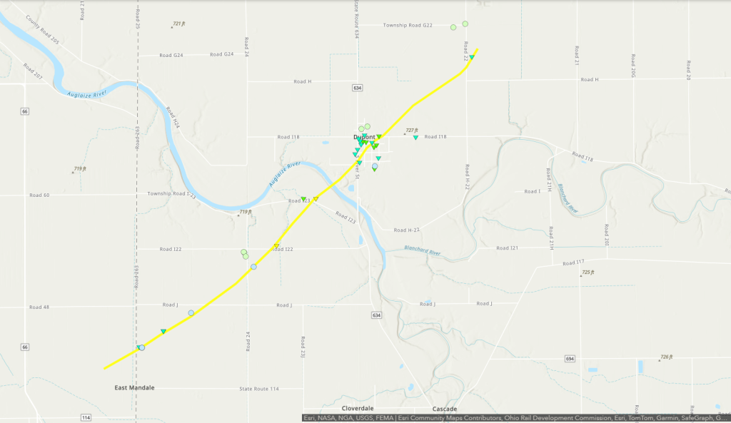
April: The Peak of Severe Weather April continued the warming trend (29th warmest) and brought heavy moisture (15th wettest). The most significant severe weather event of the year occurred on April 2–3. A squall line moved through the state producing nine confirmed tornadoes, including the year’s strongest twister: an EF2 near Mandale/Putnam County.
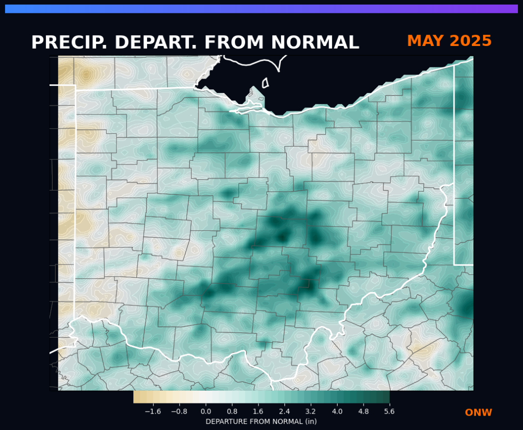
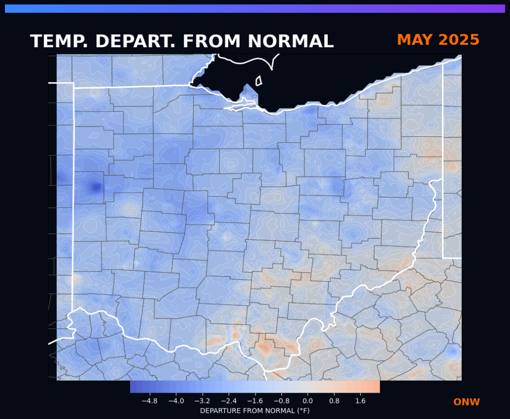
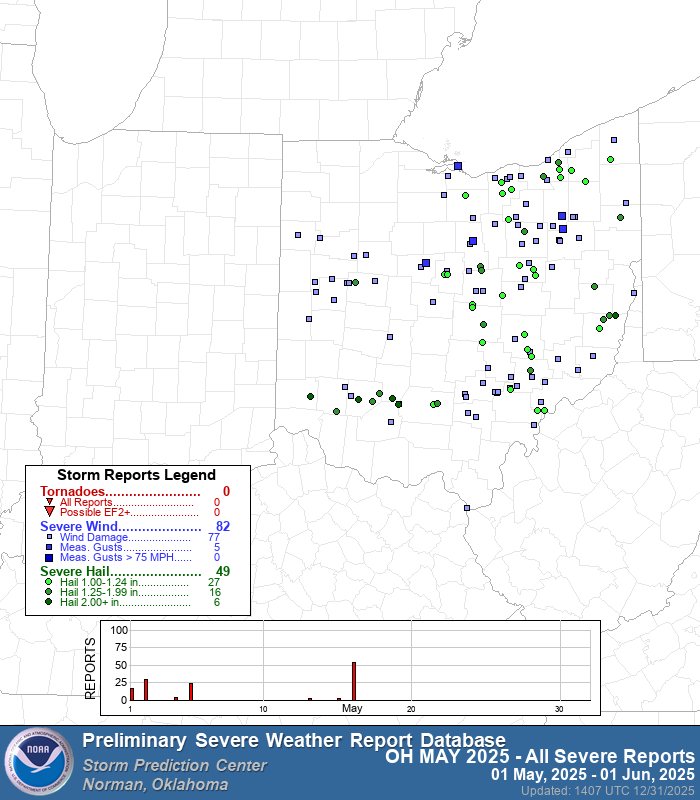
May: Cool, Wet, and Hail The pattern flipped in May, which ranked as the 52nd coldest on record. It was a soggy month for farmers, ranking as the 22nd wettest May with nearly every county seeing above-average rainfall. On May 16, a severe outbreak brought damaging winds and massive hail to the state, with reports of 3-inch stones in Highland County.
Summer: From Heat Dome to Flash Drought
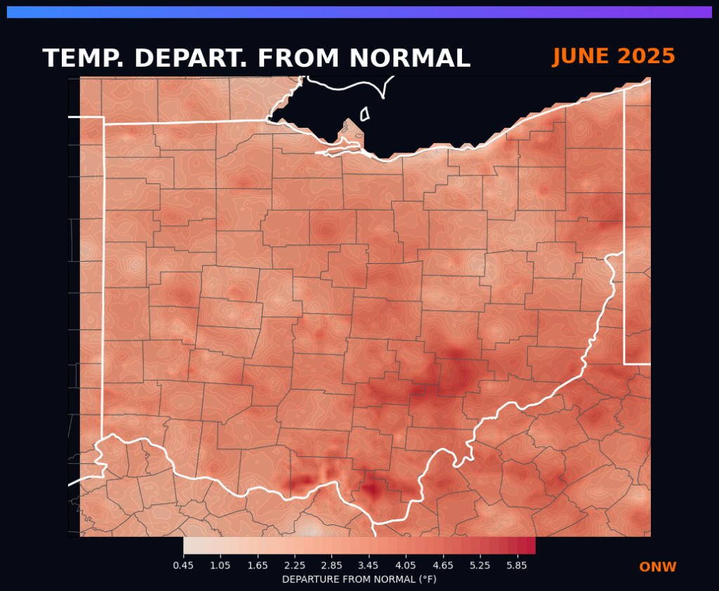
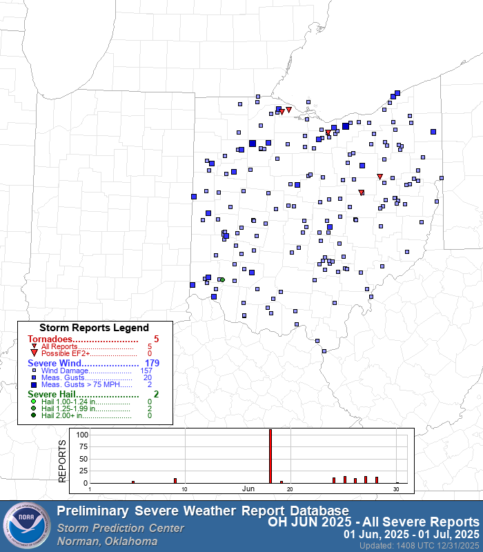
June: The Heat Dome Summer arrived with intensity. June was the 10th warmest on record, with every county in the state ranking in the top third of their historical temperature records. A severe line of storms swept through on June 18, bringing 80+ mph wind gusts and leaving over 200,000 customers without power.
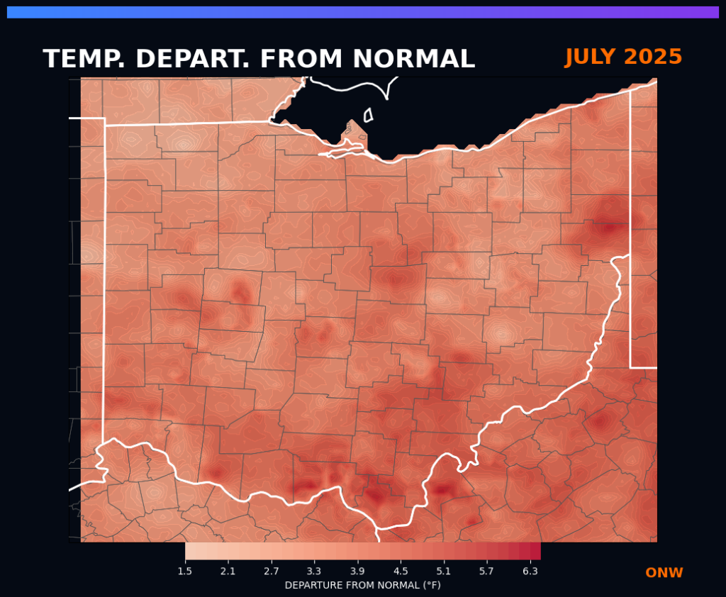
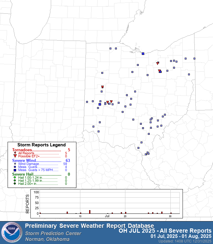
July: Steamy and Stormy The heat persisted, making this the 11th warmest July on record due to high humidity and warm nights. Precipitation was highly localized; some areas in the south saw over 7.5 inches of rain, while the north remained drier. Tornadoes touched down on July 19 and 28, causing damage in Clark and Wayne counties.
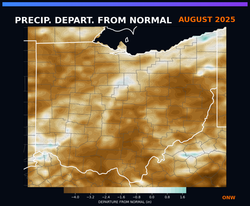
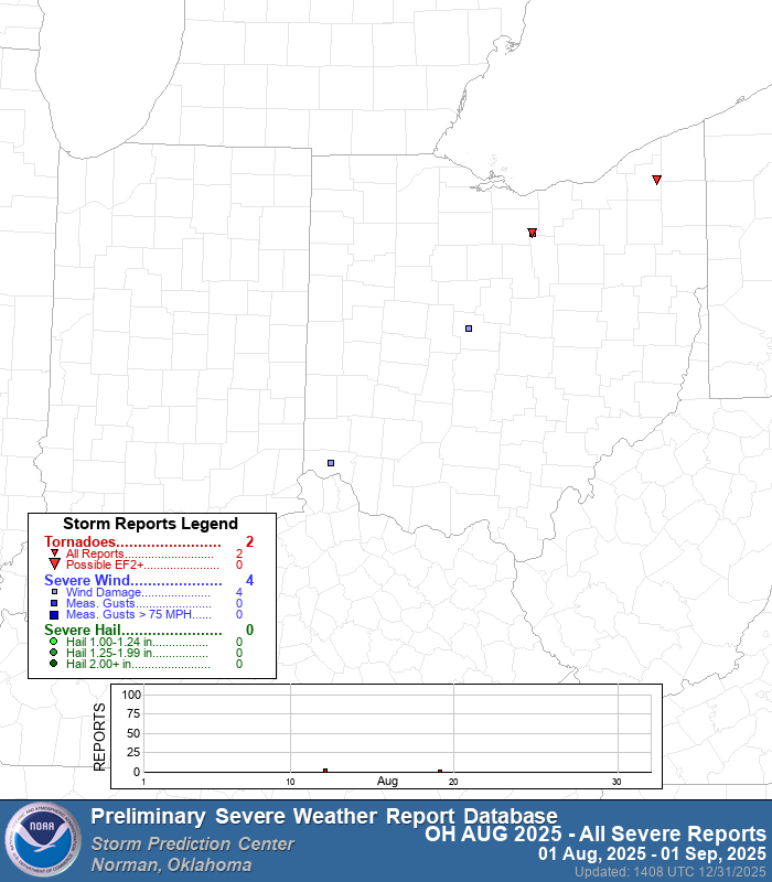
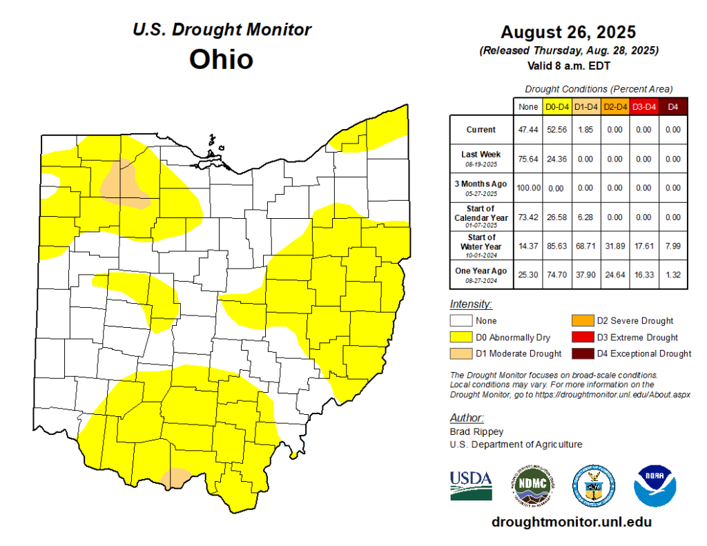
August: The Historic Pivot In a stunning reversal, Ohio entered a “flash drought.” August 2025 was the driest August on record for the state. Every county ranked in the driest third of its history, with southern and eastern Ohio hit particularly hard. Temperatures also dipped, making it the 50th coldest August, accompanied by a notable cold snap late in the month.
Fall: Drought Grip and a Thanksgiving Surprise
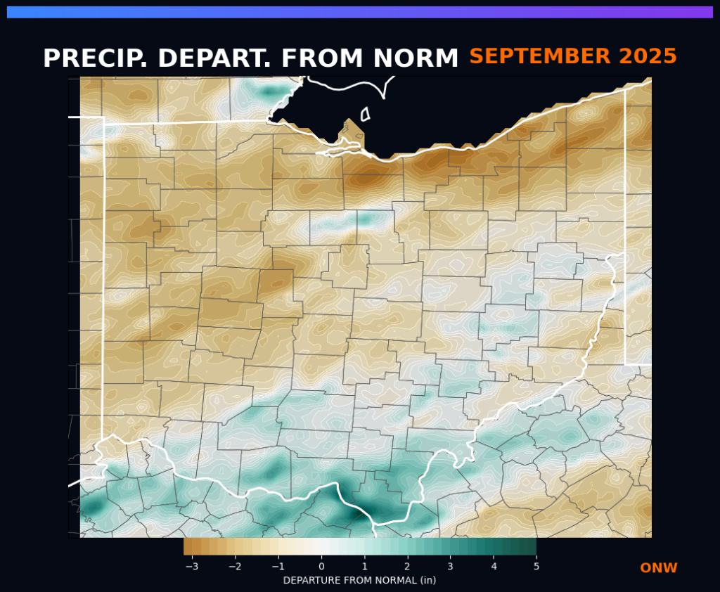
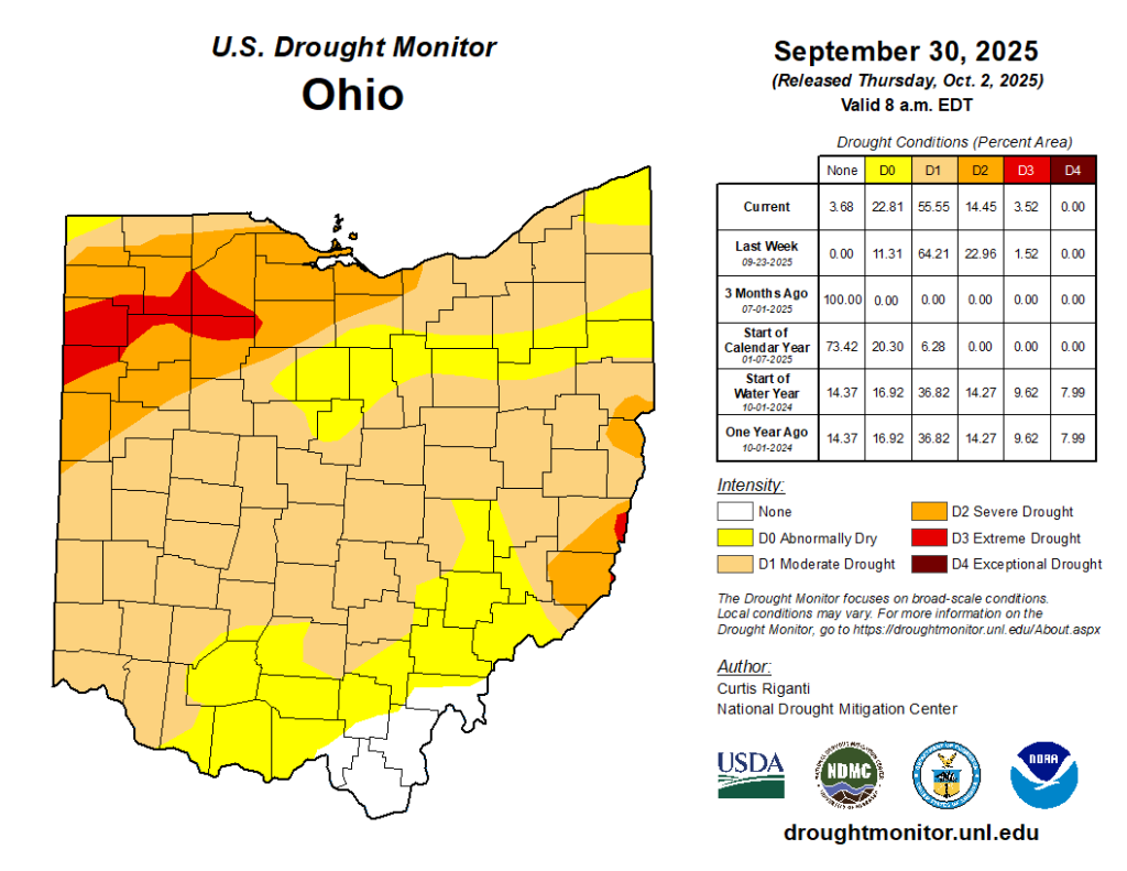
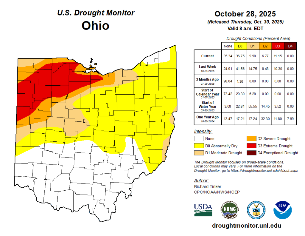
September: The Divide Warmth returned in September, but the precipitation map showed a sharp divide. Southern Ohio received 3–8 inches of rain, while the north received as little as 0.5 inches. This lack of rainfall in the north allowed drought conditions to intensify, reaching “Extreme Drought” (D3) status in Northwest Ohio.
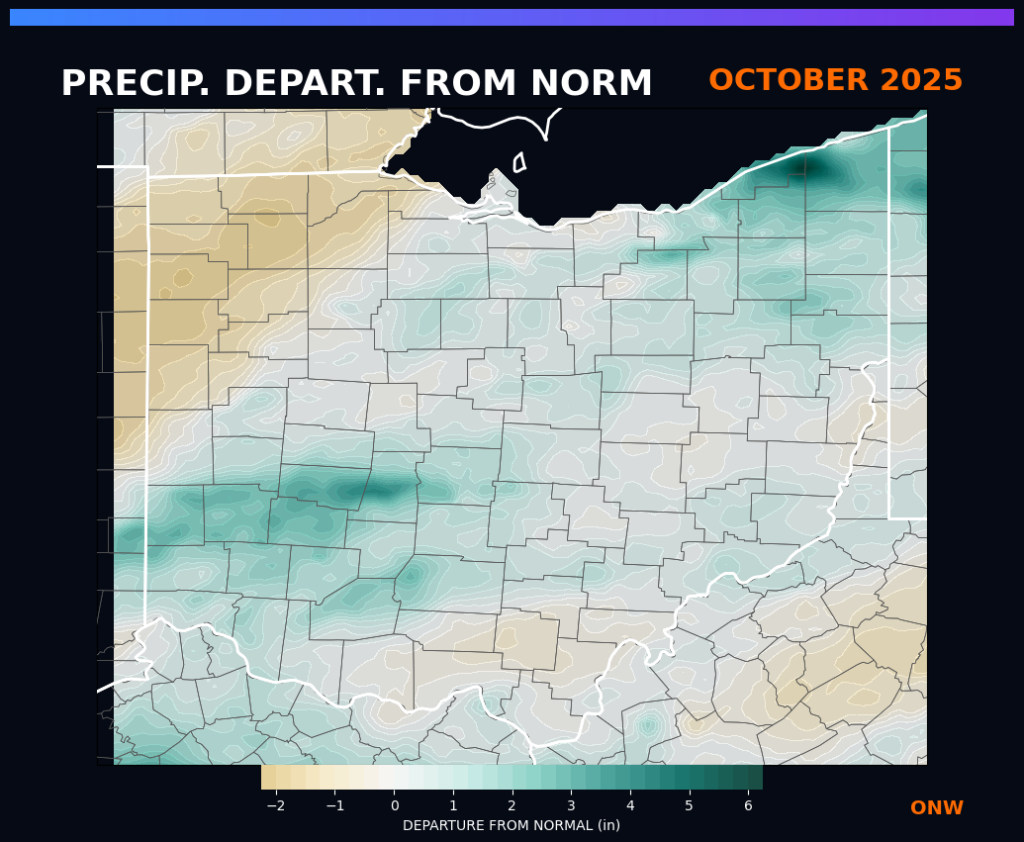
October: Dull Foliage and Record Rain The ongoing drought and warmth caused fall foliage to peak early and appear duller than usual. While the month was generally dry (48th driest), a specific event on October 7 brought record-breaking daily rainfall to Columbus (1.84 inches) and over 4 inches to South Charleston, providing localized drought relief.
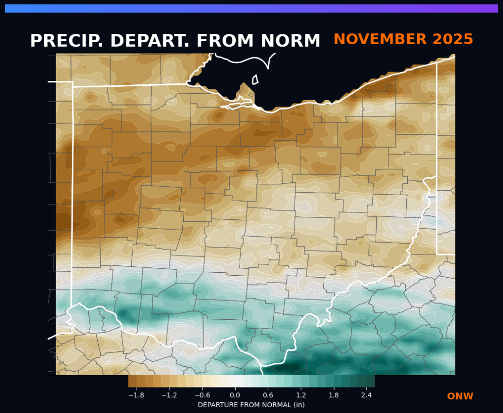
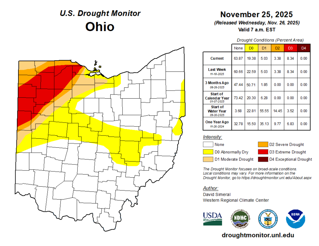
November: Winter’s Return November temperatures normalized, but the dryness persisted (48th driest). Northwest Ohio remained in extreme drought (D3) through the end of the month. However, the month ended with a bang: a significant winter storm during Thanksgiving week dropped heavy snow across Northern Ohio, with Hiram recording 15 inches of snow by November 30.
December: Brrrrr December was below average for pretty much the entire state, with some areas as much as 6 degrees below normal for the month! Despite a severe weather episode and some snow fall, it was a relatively dry month for anyone not in the primarly Snow Belt, who recevied several rounds of Lake Effect Snow.
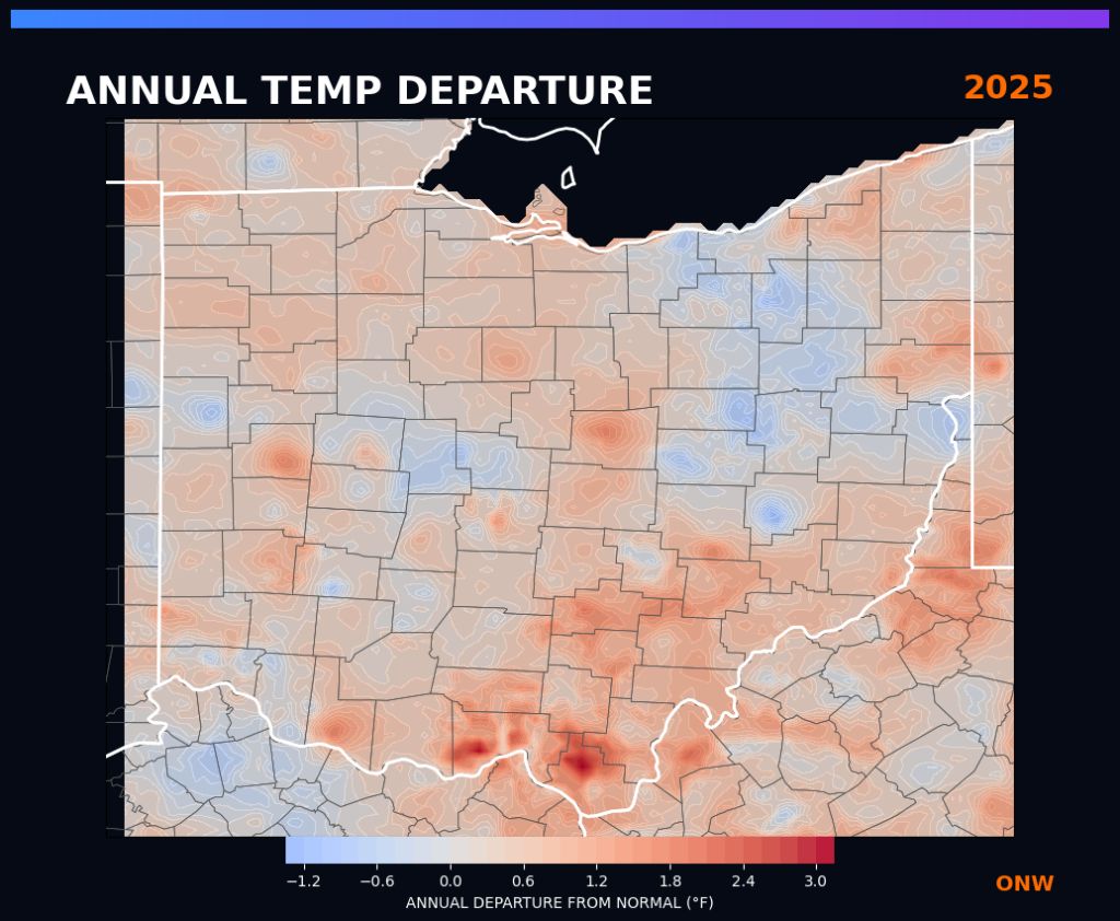
2025 By The Numbers
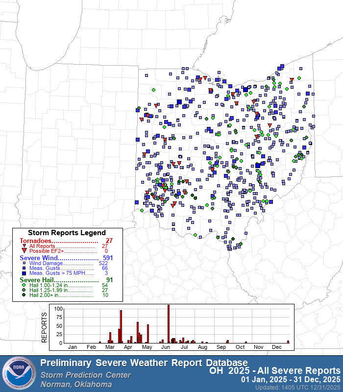
• Tornadoes: 28 Confirmed (20 EF0, 7 EF1, 1 EF2).
• Hottest Month Rank: June (10th warmest).
• Driest Month Rank: August (1st driest on record).
• Drought Status: Peaked at 73% of the state in drought during October.
Thanks for checking out our 2025 recap! Overall it was a much quieter year in terms of severe weather. We’re ready to see what 2026 brings us and ready to keep you up to date on everything you may need to know about! If there any events you would like a deep dive on, please let us know and we will make a video talking about that event!